Post History
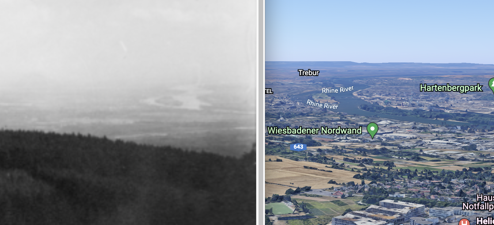
I think the image was taken from the Hohe Wurzel mountain (or one of the hills around it) looking over Wiesbaden. If one zooms in, such a viewpoint matches nicely the island in the river Rhine in ...
#2: Post edited
- I think the image was taken from the [Hohe Wurzel mountain](https://en.wikipedia.org/wiki/Hohe_Wurzel_(Taunus)) (or one of the hills around it) looking over Wiesbaden.
- If one zooms in, such a viewpoint matches nicely the island in the river Rhine in the background
- 
- (https://earth.google.com/web/search/Sender+Hohe+Wurzel,+Taunusstein/@50.10012396,8.14292616,486.74408186a,2523.06062138d,35y,137.8467912h,77.89156033t,-0r/data=CigiJgokCQ2YFZfHC0lAEewD1WwjCUlAGd0XYxCPViBAITKBjNrTRCBA)
I don't know if there were any US army activities in this area, but it seems to have a long history for radio transmitters, including one of the [major broadcasting towers of the area](https://de.wikipedia.org/wiki/Fernmeldeturm_Hohe_Wurzel).
- I think the image was taken from the [Hohe Wurzel mountain](https://en.wikipedia.org/wiki/Hohe_Wurzel_(Taunus)) (or one of the hills around it) looking over Wiesbaden.
- If one zooms in, such a viewpoint matches nicely the island in the river Rhine in the background
- 
- (https://earth.google.com/web/search/Sender+Hohe+Wurzel,+Taunusstein/@50.10012396,8.14292616,486.74408186a,2523.06062138d,35y,137.8467912h,77.89156033t,-0r/data=CigiJgokCQ2YFZfHC0lAEewD1WwjCUlAGd0XYxCPViBAITKBjNrTRCBA)
- There is a user `jskabennet` who says on http://wikimapia.org/1847834/Sendeturm-Hohe-Wurzel
- > I have a radio relay map dated Dec 67. This map shows two microwave relay links from Lindsey AS to this location. Any further details?
- which might be related to the transmitter shown in your image. Also the area seems to be popular for radio transmitters, including one of the [major broadcasting towers of the area](https://de.wikipedia.org/wiki/Fernmeldeturm_Hohe_Wurzel).
#1: Initial revision
I think the image was taken from the [Hohe Wurzel mountain](https://en.wikipedia.org/wiki/Hohe_Wurzel_(Taunus)) (or one of the hills around it) looking over Wiesbaden. If one zooms in, such a viewpoint matches nicely the island in the river Rhine in the background  (https://earth.google.com/web/search/Sender+Hohe+Wurzel,+Taunusstein/@50.10012396,8.14292616,486.74408186a,2523.06062138d,35y,137.8467912h,77.89156033t,-0r/data=CigiJgokCQ2YFZfHC0lAEewD1WwjCUlAGd0XYxCPViBAITKBjNrTRCBA) I don't know if there were any US army activities in this area, but it seems to have a long history for radio transmitters, including one of the [major broadcasting towers of the area](https://de.wikipedia.org/wiki/Fernmeldeturm_Hohe_Wurzel).


