Comments on Jig Radio, Wiesbaden?
Post
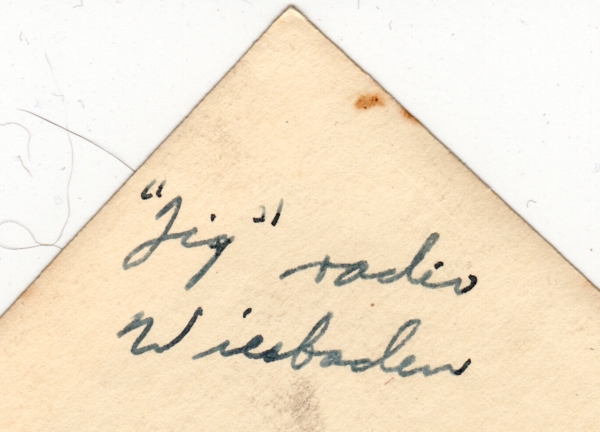
Jig Radio, Wiesbaden?
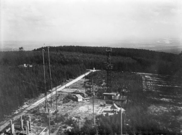
I found the picture below in a stash of things that belonged to my father.
My father served in the US army during WWII in the signal corps. He was referred to unofficially as a "radio repairman" apparently. After the war ended, he continued to be employed by the army as a civilian for a couple of years or so, primarily stationed in Berlin. However, I know he occasionally would travel to other communication installations in Europe during this time.
Probably he or someone he worked with took this picture in 1945-1946. It's his handwriting on the back, and appears to say "Jig" radio Wiesbaden. The military often had short codenames for things like radio installations, and him traveling to Wiesbaden Germany seems quite plausible.
I'd like to know more about this picture, like the location, historical context, etc. I tried searching for "Jig Radio" and "Wiesbaden", but didn't find anything from that era. Looking around Wiesbaden with Google Earth wasn't helpful, probably because things look quite different today.
I'm guessing that the picture was taken by climbing up a radio tower. He or a buddy who might have taken the picture would have had that kind of access. This could have been a temporary US army installation, but could also have been a German installation taken over by the US after the war.
Clues in the picture
The trees being in neat rows at right, and the fixed height of various stands, shows that this was a highly managed forest for many years. It wasn't just in the "middle of nowhere".
The shadows show that the sun was a bit below 45° height in the sky. Wiesbaden is at 50°N, so the average sun angle at noon would be 40°. This means the picture was taken near the middle of the day, which in turn means the view is towards the east. There are hills west of Wiesbaden, so this picture could have been taken from one of them. If someone here happens to know the area, I'd love to get more information, especially historical context.

2 comment threads